Blue Hole
Near Rawley Springs, Virginia · on Dry River
Verified · 3 independent sources · top-verified
- WATER
- river
- ACCESS
- Local spot, unofficial
- FEE
- No fee found
- SEASON
- Varies by conditions
About Blue Hole
Blue Hole is a natural pool on the Dry River just off US Route 33 near Rawley Springs, Virginia, within the boundary of the George Washington National Forest but on land actually owned by Rockingham County. For decades this swimming hole was a popular, if informal, cliff-jumping spot and stretch of river to swim in, but the county permanently closed it to the public in August 2020 over parking and safety concerns.
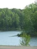
The pool sits in a narrow forested stretch of the Dry River valley right alongside US Route 33, with the George Washington National Forest boundary surrounding the property even though the swimming hole itself is county-owned land rather than Forest Service land.
Swimming at Blue Hole
First-hand accounts describe a deep, cool pool with tall streamside rocks used for jumping, plus a homemade ladder that let swimmers climb to a jumping ledge; one visitor estimated the water at roughly 10 feet deep. It drew a mostly informal crowd, including college students from nearby James Madison University, rather than families seeking a developed swim area.
How to get to this swimming hole
Historically reached by parking on the shoulder of US Route 33 west of Rawley Springs, Virginia (about 12 miles west of Harrisonburg), then following an unmarked rocky path down to the river; that shoulder is now signed no-parking/tow-away and the path is posted no-trespassing.
Parking: No formal lot; swimmers historically parked on the US Route 33 road shoulder. As of July 2025 those shoulder spots are marked as tow-away/no-parking zones.
The hike in
Difficulty: Not a maintained trail -- described by first-hand reviewers as a short, unmarked, rocky path/deer path down from the highway shoulder, easy to miss if you don't already know where it is.
Trailhead: No official trailhead -- historically accessed by parking on the US Route 33 shoulder west of Rawley Springs, VA (about 12 miles west of Harrisonburg) and following an unmarked rocky/deer path down to the river. That access point is now posted private property/no trespassing.
No published distance or maintained trail exists; this was always an informal bootleg path rather than a signed hiking trail, and it is now blocked by no-trespassing signage per the July 2025 Wikipedia account.
Plan your visit
Bringing kids
Not ideal for young kids
Site has been permanently closed to the public by Rockingham County since August 2020 (no-trespassing signage, tow-away parking enforcement as of a July 2025 account). Even setting access aside, historical first-hand reviews describe cliff/rock jumping, a homemade ladder to a jump ledge, no lifeguards, and roadside parking on a 55 mph curve of US-33 -- none of which is child-friendly.
Parking
No dedicated parking
Swimmers historically parked on the US Route 33 shoulder west of Rawley Springs; as of a July 2025 account those shoulder spots are now posted no-parking/tow-away zones and enforced by the Rockingham County Sheriff's Office.
Restrooms
None on site
No restroom or facilities of any kind reported at this informal roadside spot; it was never a developed park site and is now closed to the public entirely.
On the water
No evidence found of kayaking, canoeing, or paddleboarding at this spot. The Dry River here is a narrow, rocky mountain trout stream rather than a boating destination, and the swimming hole itself is now closed to public access entirely, making watercraft use moot.
Backstory
The 4.5-acre property was donated to Rockingham County in 1973 by Bill and Barbara Neff, with the county formally accepting the deed in 1977. County officials debated closing the site over safety and parking concerns for roughly two decades before the Board of Supervisors voted to close it permanently in August 2020.
Blue Hole: FAQ
Is Blue Hole kid friendly?
Site has been permanently closed to the public by Rockingham County since August 2020 (no-trespassing signage, tow-away parking enforcement as of a July 2025 account). Even setting access aside, historical first-hand reviews describe cliff/rock jumping, a homemade ladder to a jump ledge, no lifeguards, and roadside parking on a 55 mph curve of US-33 -- none of which is child-friendly.
How hard is the hike to Blue Hole?
A hike is required. Wear real shoes, since approaches to natural swim spots are often rocky or rooty.
Where do I park for Blue Hole?
Swimmers historically parked on the US Route 33 shoulder west of Rawley Springs; as of a July 2025 account those shoulder spots are now posted no-parking/tow-away zones and enforced by the Rockingham County Sheriff's Office.
What are the rules at Blue Hole?
Rockingham County Board of Supervisors voted in August 2020 to permanently close Blue Hole to the public; the Sheriff's Office now enforces trespassing and towing, and the access path is posted private property/no trespassing.
What water body is Blue Hole on?
Blue Hole is on Dry River, a natural river verified in USGS hydrography data.
More swimming holes near Rawley Springs
 ★ Top verified
Blue Hole Day Use Area
Bergton, Virginiariver
⛺
 ★ Top verified
Trout Pond Campground
Lost City, West Virginialake
⛺🛶🏄
 ★ Top verified
Lake Arrowhead
Luray, Virginialake
⛺🛶🏄🚤
 ★ Top verified
Sherando Lake Recreation Area
Lyndhurst, Virginialake
⛺🛶🏄🚤
 ★ Top verified
Chris Greene Lake Park
Charlottesville, Virginialake
⛺🛶🏄🚤
Walnut Creek Park
North Garden, Virginialake
🛶🏄🚤