Blanchard Springs Day Use Area
Mountain View, Arkansas · on North Sylamore Creek · Ozark National Forest
Verified · 4 independent sources · top-verified
- WATER
- creek
- FALLS
- Waterfall on site
- ACCESS
- Designated swim area
- FEE
- $3 per vehicle
- SEASON
- Varies by conditions
About Blanchard Springs Day Use Area
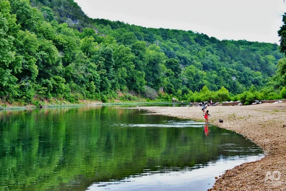
Blanchard Springs Day Use Area is a U.S. Forest Service site in the Ozark National Forest near Mountain View, Arkansas, where North Sylamore Creek runs through a bluff-lined valley. The Forest Service explicitly designates the creek here for swimming, and the area is known locally for two distinct swimming holes along the creek.
The site sits within the Blanchard Springs Recreation Area, described by the Forest Service as featuring picturesque rock bluffs and beautiful crystal-clear streams amid wooded Ozark hillsides. North Sylamore Creek, a designated Wild and Scenic River for a 14.5-mile scenic reach from the Clifty Canyon Botanical Area to its confluence with the White River, runs through the complex alongside the well-known Blanchard Springs Caverns and a spring-fed waterfall reached by a paved trail.
Swimming at Blanchard Springs Day Use Area
The Forest Service lists swimming in 'the clear waters of North Sylamore Creek (swim at your own risk)' as an activity at the Day Use Area. Local coverage describes two separate swimming holes on the creek: a main 'Lower Hole' near the developed Day Use Area with a bathhouse and small pavilion, and an 'Upper Hole' near the upper campground loop, reached by crossing a low-water bridge, at a large bluff. Both holes reportedly have rope swings for jumping/diving into the water, and having two locations lets visitors move to the other if one is crowded.
How to get to this swimming hole
From Mountain View, take Arkansas Highway 14 west about 12.1 miles (one source says ~6.6 miles from Fifty-Six, AR); turn at the signed entrance for Blanchard Springs Caverns and follow signs to the Day Use Area and Recreation Area facilities. The upper swimming hole is reached by continuing toward the campground loop and crossing North Sylamore Creek on a low-water bridge.
The hike in
This is a drive-up day-use area; no hike is needed to reach either swimming hole from the parking area. A separate paved trail leads a short distance to the Blanchard Springs waterfall, and the North Sylamore Creek Trail and Syllamo Mountain Bike Trail are accessible from the recreation area for those who want to hike/bike afterward, but neither is required to reach the swim spots.
The 'Upper Hole' requires crossing a low-water bridge near the upper campground loop (a short walk/drive, not a hiking trail) per local coverage; exact walk distance from the nearest parking to each hole was not found in any source and is left null.
Plan your visit
Bringing kids
OK with supervision
USFS designates the creek for swimming but explicitly labels it 'at your own risk' with no lifeguards. Local coverage notes rope swings for jumping/diving at both the Lower and Upper holes, and periodic bacteria advisories can close the area, so younger kids should be supervised closely and away from the swing/jump zones.
Parking
Paid, $3/vehicle/day
USFS lists a $3 per vehicle day-use fee for Blanchard Springs Day Use Area; the page does not specify lot capacity or whether overflow roadside parking exists.
Restrooms
Yes
A bathhouse and small pavilion are on site at the main (Lower Hole) Day Use Area per a regional Ozarks guide; nearby Blanchard Springs Recreation Area/campground restrooms include hot showers (seasonal). The official USFS day-use page itself does not itemize restroom facilities.
Water clarity
Clear
USFS's own site pages describe the Blanchard Springs area streams as 'beautiful crystal-clear streams' and specifically invite visitors to 'swim in the clear waters of North Sylamore Creek.' No independent visitor confirmation could be retrieved in this pass, so this is sourced to the official description only.
Hours
Blanchard Springs Day Use Area is open all year per the USFS site page; the adjacent Blanchard Springs Caverns visitor center posted limited hours (Monday and Wednesday, 8:00 AM-4:00 PM) at the time of this check, which may reflect a reduced/seasonal schedule worth confirming before a visit.
On the water
Restrictions: USFS recreation-area material lists 'non-motorized boating' among the activities at Blanchard Springs Recreation Area, implying motorized craft are not used/appropriate on this stretch of North Sylamore Creek; no explicit electric-only or no-wake rule was found stated in those terms.
No put-in/take-out specifics, minimum-flow requirements, or seasonal floatability notes for this exact reach were found; treat as a small, shallow Ozark creek better suited to canoe/kayak/tube floats than large motorboats.
Backstory
North Sylamore Creek received federal Wild and Scenic River designation on April 22, 1992, protecting a 14.5-mile scenic-classified reach from the Clifty Canyon Botanical Area boundary to its confluence with the White River.
Blanchard Springs Day Use Area: FAQ
Does Blanchard Springs Day Use Area charge a fee?
$3 per vehicle for day use, per the U.S. Forest Service fee schedule; separate camping fees apply ($15/night per campsite, $60/night large group camp, $35/night small group site) and pavilion/amphitheater rental fees ($20-$60) are listed for the broader recreation area.
Is Blanchard Springs Day Use Area kid friendly?
USFS designates the creek for swimming but explicitly labels it 'at your own risk' with no lifeguards. Local coverage notes rope swings for jumping/diving at both the Lower and Upper holes, and periodic bacteria advisories can close the area, so younger kids should be supervised closely and away from the swing/jump zones.
Do I need to hike to reach Blanchard Springs Day Use Area?
No significant hike is required. The swimming area is close to parking and access.
Where do I park for Blanchard Springs Day Use Area?
USFS lists a $3 per vehicle day-use fee for Blanchard Springs Day Use Area; the page does not specify lot capacity or whether overflow roadside parking exists.
Can I bring a kayak or paddleboard to Blanchard Springs Day Use Area?
No put-in/take-out specifics, minimum-flow requirements, or seasonal floatability notes for this exact reach were found; treat as a small, shallow Ozark creek better suited to canoe/kayak/tube floats than large motorboats.
What are the rules at Blanchard Springs Day Use Area?
Forest Service notes swimming is 'at your own risk.' Local guidance advises that higher-than-normal bacteria counts can close a swimming area, and recommends calling the Sylamore Ranger District (870-269-3228) ahead of a visit to confirm conditions.
What water body is Blanchard Springs Day Use Area on?
Blanchard Springs Day Use Area is on North Sylamore Creek, a natural creek verified in USGS hydrography data.
More swimming holes near Mountain View
 ★ Top verified
Buffalo Point Campground
Yellville, Arkansasriver
⛺🛶🛟🚤
 ★ Top verified
Grinder's Ferry
St Joe, Arkansasriver
⛺🛶🛟
Tyler Bend Campground
St Joe, Arkansasriver
⛺🛶🛟
 ★ Top verified
Woolum Ford
St Joe, Arkansasriver
⛺🛶🛟
Buford Beach/Hardy
Hardy, Arkansasriver
🛶🏄🚤
 ★ Top verified
Steel Creek Campground
Jasper, Arkansasriver
⛺🛶🛟